Summary
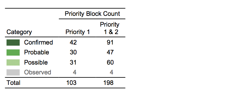
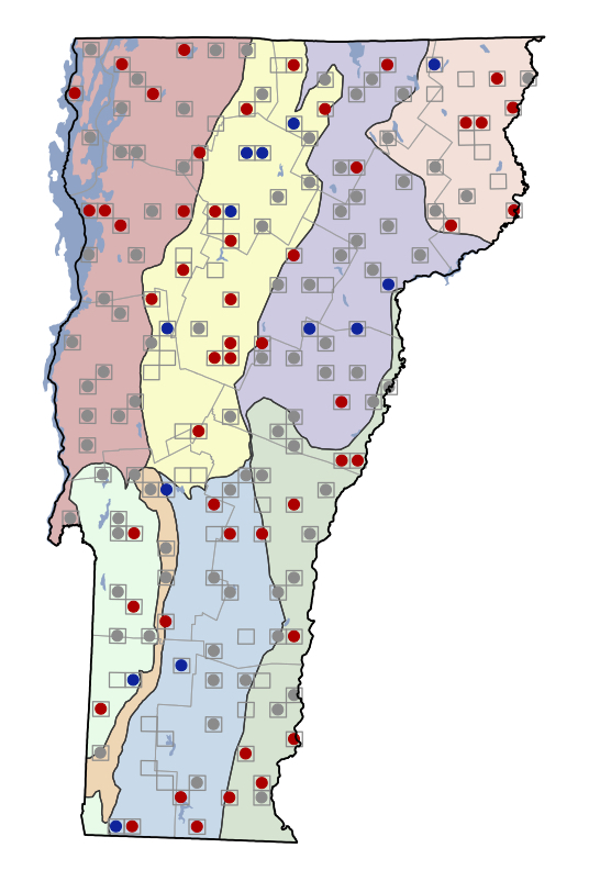
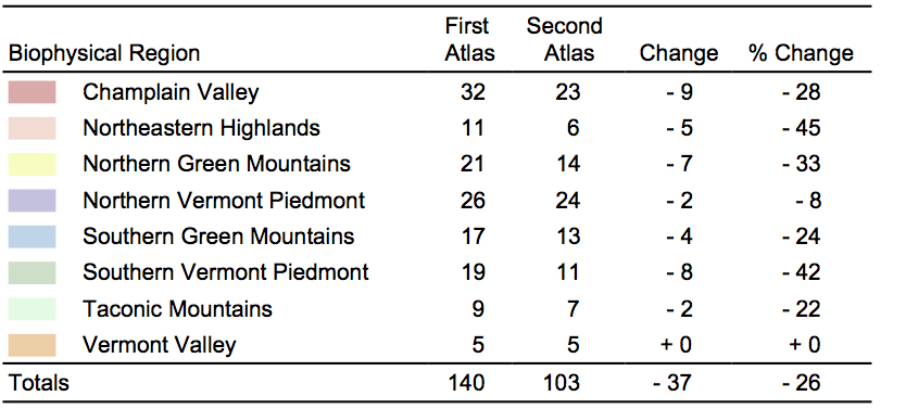
- Status in VT: Declined by 26% (140 to 103 blocks). Greatest losses in Northeastern Highlands and Southern Vermont Piedmont.
- Data from other research: No additional data in VT.
- Conservation status: State rank S4B; SGCN-M; SSC
- Other atlases: NY: -14%; PA: -13%; MD: -33%; ON: -9 to -88%
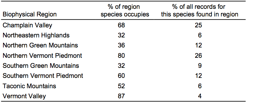
- VT’s role in North American range: VT is within the core of the range.
- Causes of change since first Atlas: Loss of agricultural areas due to forest succession and urban/suburban development, loss of cavities due to removal of hedgerows, habitat fragmentation. Possibly also West Nile Virus, increased predation from Cooper’s Hawk, collision with vehicles (especially for young).
- Management/Monitoring recommendations: Maintain grassland/scrubland habitat through management; landowner education to encourage awareness by farmers; use of kestrel-specific nest boxes placed 10-30 ft (3-9 m) high.
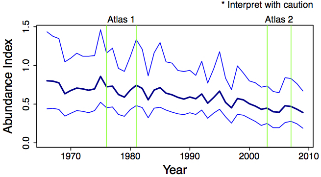
Population Trends
First Vermont Breeding Bird Atlas (1976-1981)
Second Vermont Breeding Bird Atlas (2003 – 2007)
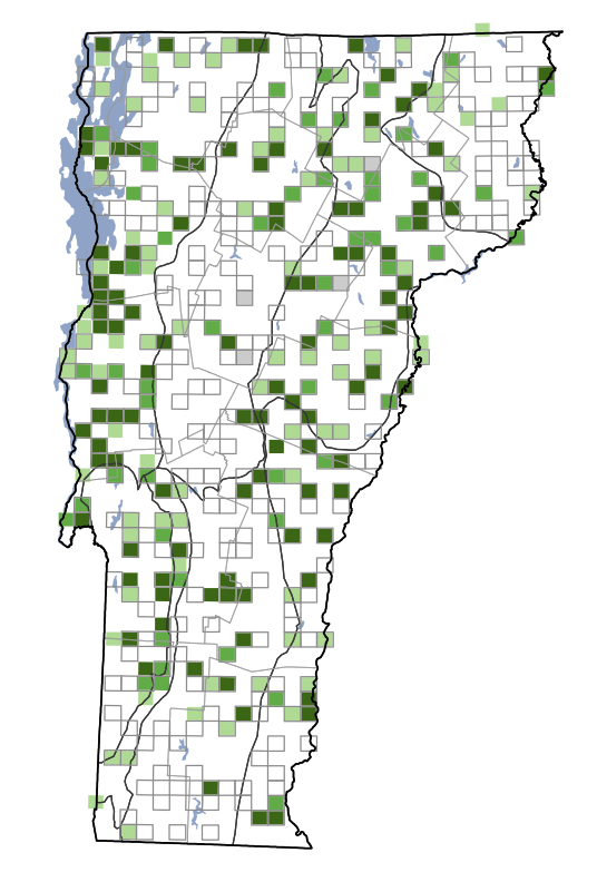
Change in Distribution
Links