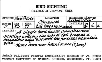
Historical data represent a precious source of information that help to establish baselines for present and future biodiversity and global change studies. Unfortunately, primary biodiversity data are lost every day.
The Vermont Atlas of Life’s Project Phoenix aims to rescue historic biodiversity records, some a century old, now trapped in notebooks, on scraps of paper, and in old file drawers, or outdated computer files. "Data rescue" involves moving information at risk of being lost into electronic format so they can be used for present and future analyses.
Sharing and Archiving Historic Primary Biodiversity Data
Data sharing has become an important issue in modern biodiversity research to address large scale questions and conserve species. Despite the steadily growing scientific and conservation demand, data are not always easily accessed. Worse, it may be lost forever if it is not properly archived.
The Phoenix Project is:
- Digitizing raw data in tables from paper reports, dissertations, and theses.
- Extracting raw data from field notebooks, some over a century old.
- Locating, verifying, and databasing primary biodiversity data that have never been published.
- Determining primary biodiversity data that were originally identified at a low taxonomic resolution (i.e. not to species).
- Filling in important metadata and other missing details in existing datasets to make them more valuable.
The Vermont Atlas of Life has been an official Global Biodiversity Information Infrastructure (GBIF) biodiversity data publisher since 2018. GBIF is an international network and research infrastructure funded by the world’s governments and aimed at providing anyone, anywhere, open access to data about all types of life on Earth.
The GBIF network includes hundreds of institutions that publish biodiversity data, like the Vermont Atlas of Life. Coordinated through its Secretariat in Copenhagen, the GBIF network of participating countries and organizations, working through participant nodes, provides data-holding institutions around the world with common standards and open-source tools that enable them to share information about where and when species have been recorded. This knowledge derives from many sources, including everything from museum specimens collected in the 18th and 19th century to geotagged smartphone photos shared by amateur naturalists in recent days and weeks.
The GBIF network draws all these sources together through the use of data standards, such as Darwin Core, which forms the basis for the bulk of GBIF.org’s index of hundreds of millions of species occurrence records. Publishers provide open access to their datasets using machine-readable Creative Commons licence designations, allowing scientists, researchers and others to apply the data in hundreds of peer-reviewed publications and policy papers each year. Many of these analyses—which cover topics from the impacts of climate change and the spread of invasive and alien pests to priorities forconservation and protected areas,food security and human health— would not be possible without this.
Data found at VAL and GBIF are provided by a wide range of cooperating organizations, websites, individuals, community groups, citizen scientists, government agencies and others. VAL works closely with data providers to assist them to better capture, manage, and share biodiversity data.
Volunteer
Do you have time to help digitize old records? Stay tuned! We’ll post calls for help here.
Data Rescue Projects
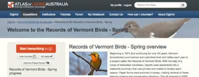
Records of Vermont Birds - Spring Migration Phenology
With the help of volunteers, we scanned nearly 6,000 pages and 7,000 note cards from reports by bird watchers from 1974-1999. Atlas of Living Australia (ALA), which in collaboration with the Australian Museum has developed DigiVol. DigiVol allows volunteers to view scans of the paper documents online, and convert them on the spot to digital form. We are now adding the records to Vermont eBird along with over a century of other spring bird records. IN PROGRESS »
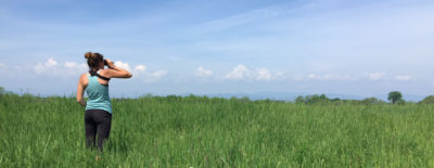
Historic Henslow's Sparrow Records from Vermont
Henslow's Sparrows are secretive grassland birds whose distribution ranges from northeastern Oklahoma east and north to the Great Lakes states and eastern New York then south to northern Tennessee. Henslow's Sparrows are short distance migrants that winter in the southern U.S. This species, like many other grassland species, expanded its range into the Northeast during the land-clearing period in the 1800's. However populations in the Northeast (eastern subspecies) have declined with the loss of grassland habitats. As a result, Henslow's Sparrow is currently listed as Endangered in Vermont. Other than the sporadic records from the first half of the 1900's little information has been collected concerning Henslow's Sparrow. It was reported from two locations during the first Vermont Breeding Bird Atlas Project. We are digitizing all historic records and 1992 survey locations from the Henslow's Sparrow Vermont Status Report 1992 (see https://val.vtecostudies.org/wp-content/uploads/2023/11/Henslows-Sparrow-VT-Status-Report-1992.pdf). In Progress »
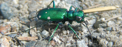
Digitizing Historic Dot Maps of Carabid Beetle Records from Vermont and New Hampshire
Vermont has not benefited from formal statewide surveys for these groups. Instead, we draw on more than 50 years of recorded observations from the work of Ross and Joyce Bell. During the 1960s the Bells began a program to document the fauna of Vermont and to compile extensive records of natural history information. Through this work they built the UVM Entomological Collection into an important resource for science and conservation, and they inspired us here at VCE to launch the Vermont Atlas of Life, where we’ve helped to digitize, publish, and archive some of their amazing work, including their hand drawn Vermont dot maps for all these species. Learn more at GBIF »
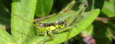
Digitizing Historic Dot Maps of Vermont Orthoptera
During the 1960s Ross and Joyce Bell began a program to document the fauna of Vermont and to compile extensive records of natural history information, including all the Orthoptera. We’ve digitize and archived their amazing hand drawn Vermont dot maps for all the species they encountered during surveys. Learn more »
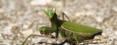
Digitizing Historic Dot Maps of European Mantis Records in Vermont
During the 1960s Ross and Joyce Bell began a program to document the fauna of Vermont and to compile extensive records of natural history information, including all the European Mantis. We’ve digitize and archived their amazing hand drawn Vermont dot map for all the specimens they encountered during surveys. More at GBIF »
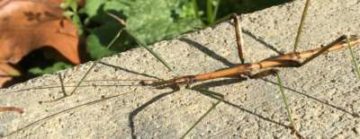
Vermont Northern Walkingstick (Diapheromera femorata) Records from Historic Dot Map
During the 1960s Ross and Joyce Bell began a program to document the fauna of Vermont and to compile extensive records of natural history information, including all the Northern Walkingstick. We’ve digitize and archived their amazing hand drawn Vermont dot map for all the specimens they encountered during surveys. More at GBIF »
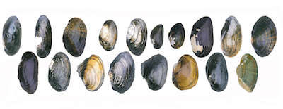
Historic Freshwater Mussel Atlas
In Vermont, 10 of the 18 native species, or 55%, are listed under the state endangered species law, and several others are considered rare. A 1995 atlas compiled freshwater mussel records from museum collections, private shell collections, and field records of biologists that were working in Vermont at the time. Their dataset comprised of records from 270 sampling sites across the state. We rescued these data from outdated computer software. Since this seminal work, many freshwater mussel surveys have occurred in parts of the state to better document endangered species locations, as part of endangered species permitting for projects. We are slowly digitizing these surveys that have been conducted by governmental agencies, conservation organizations, consultants, and naturalists. Our cursory inventory of historic datasets suggests that there are likely over 10,000 freshwater mussel occurrence records scattered among a variety of sources, and there are likely many more that remain to be discovered. Learn more »
iDigBees Vermont
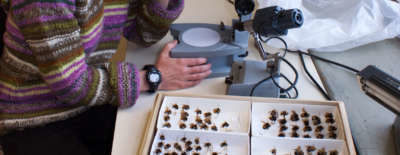
The goal for iDigBees (https://idigbees.org) is to transcribe 1.8 million records of bees with thousands of hi-res image, complete a DNA barcode library for bees from the United States, and coordinate education-community engagement programs - all with nearly 30 research groups, including VAL. As part of the Vermont Bumblebee Atlas and the Wild Bee Survey, VAL is nearly finished with digitizing and determining specimens to species from UVM Natural History Collections, Middlebury College, Yale University, Fairbanks Museum, and other public and private collections. More at the Wild Bee Survey »
Historic Upland Sandpiper Breeding Season Surveys
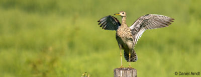
We are rescuing primary survey data from old paper reports and field data forms that have been carefully filed in a cabinet for over 30 years. Upland Sandpiper breeding season roadside surveys were completed in 1988-1992 and again in 1998-1999. In 1991 volunteers found 126 birds at 47 sites. By 1999 there were just 28 birds at 15 sites. They likely have been the victims of loss and fragmentation of grassland habitat as well as earlier and more frequent haying. They are now listed as Endangered in Vermont. Learn more »
Historic Lady Beetle Specimens Indicate Alarming Losses
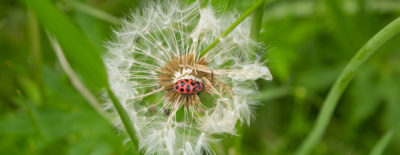
Lady Beetles weren’t on our radar until we unearthed a 43 year old document – Lady Beetles: A Checklist of the Coccinellidae of Vermont. Within its pages, the authors had noted the first and last date each Lady Beetle species was collected in Vermont and the total number of specimens known. This data showed that native species previously considered common across the state were now rare or even missing. Alarm bells started going off and we knew that this puzzle needed answers. We've now transcribed and identified thousands of historic specimens from the UVM Natural History Museum, Vermont Forest, Parks and Recreation Insect Collection, Middlebury College Collection, Fairbanks Museum, and others. The inspired us to start the Vermont Lady Beetle Atlas. Visit the Atlas »
