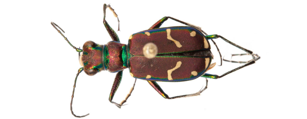
General Range
Upper Canadian to Transitional (east of IL) or Upper Austral (west of IL) Zones. North to southern NF, Anticosti Island, north shore of the Gulf of Saint Lawrence, northern ON up to the tree line, southern three-fourths of MB and SK and a strip extending north along the Mackenzie River. West beyond the Rockies but not penetrating the Columbia River valley or Great Basin, south in the Great Plains to northern NM, south to northern KS, western and northern IL, extreme north of IN and OH, western PA, and northern half of NJ.
Local Range
Bell (2015) reported it from 12 locations, all in the northern part of the state, including Westford, Waterbury, Duxbury, Worcester, W. Elmore, Plainfield, Cabot, Westmore, on Mt. Mansfield up to 1225 meters and east side of Mount Hunger (Worcester) up to 900 m elevation. There are no records from the Champlain lowlands. Several more recent locations can be viewed at iNaturalist Vermont.
Habitat
Usually steep, moist bare clay soil, including open hill tops, dirt roads, and especially river or stream banks.
Life Cycle
Mating and egg-laying occur in May and early June. According to Hamilton (1925) this species reaches only the second instar by fall and overwinters in this stage. Pupation is in the following July and new adults appear in August. Some new adults remain in the pupal chamber and do not start feeding until the next spring. Dunn (1981a) considered this to be a spring-fall species but at a W. Elmore site, adults were present throughout the summer (Bell 2015).
Behavior
The larval burrow is unusual in being largely horizontal except for the outer end, which is perpendicular to the soil surface, usually there is a short chimney of soil around the entrance. The burrow is 7-10 cm deep (Hamilton 1925).
Conservation Status
Ranked as vulnerable in Vermont (S3S4).
Flight Period
Known dates in Vermont: May 18 – September 28