Black Sandshell is widespread across the eastern U.S. and Canada, occurring from the Great Lakes basin south into Mississippi River drainage to Louisiana and in some Gulf Coast drainages.
Key Characteristics
- Size: Large; length up to 10 inches
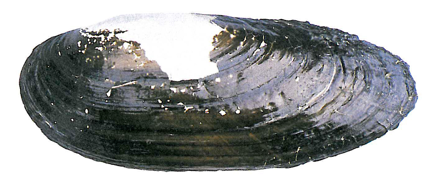
- Shape: Elongate and quadrate in shape. The shell is usually thick, heavy and somewhat inflated.
- Periostracum: Smooth, shiny, dark green or brown. Older specimens tend to be more black. The valves sometimes have green rays.
- Lateral Teeth: Well-developed; the left valve has 2, the right valve has 1.
- Pseudocardinal Teeth: Well-developed; the left valve has 2, the right valve has 1.
- Nacre: Varies. It can be white, pink, salmon, or purple-colored.
- Similar Species:
Conservation Status
- IUCN: Species of Least Concern
- State and Global Rank: S1 G4G5
- Vermont Endangered Species Law: Endangered
- Vermont Wildlife Action Plan: Species of Greatest Conservation Need
Habitat
Riffle and run areas of larger rivers in sand or gravel and lakes with sandy mud, firm sand, or gravel. It seems to prefer areas with visible, strong currents.
Host Species
Banded killifish, white perch, central stoneroller, redfin shiner, rosyface shiner, redbreast sunfish, green sunfish, longear sunfish, orangespotted sunfish, pumpkinseed, rock bass, largemouth bass, walleye and yellow perch.
More Information
Range
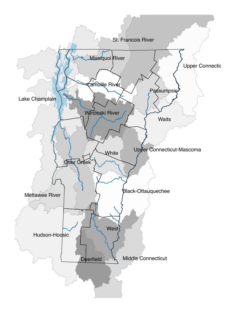
The black sandshell has always been rare in Vermont and is presently known to inhabit only two streams, the Poultney River (West Haven) and Otter Creek (Ferrisburg and Vergennes). Also found in the Missisquoi River (Highgate) and Hospital Creek (Addison), in the late1970s. It is infrequently encountered in the Poultney River and Otter Creek.

Distribution map has locations where this species has been documented and digitized into the atlas database. Systematic surveys have not been conducted for many species and those surveys that have been conducted have been largely focused on endangered species. Therefore, in some cases, the actual distribution of freshwater mussels may be more extensive than what is presented here. Shaded areas are watershed sub-basins and river main stems are shown.


