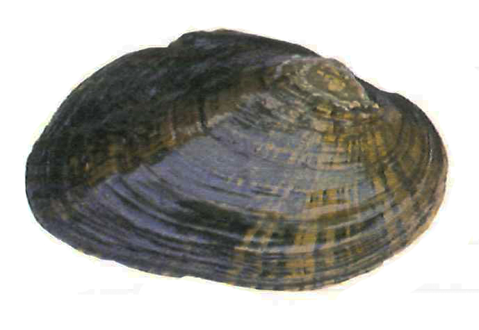
 The Brook Floater is one of the most endangered mussels in northeastern North America. It has experienced significant declines throughout its range, with many populations having been extirpated. The Brook Floater is generally not abundant in rivers where it occurs. It is a very rare species in Vermont only known from the West River and this population appears to be declining.
Key Characteristics
- Size: up to 3 inches
- Shape: Trapezoidal to elliptical with a pronounced posterior ridge. The ventral margin is generally flat with somewhat inflated valves. There are grooves along the dorsal-posterior slope that lie perpendicular to growth lines.
- Periostracum: Yellow-green to brown-black with green rays.
- Lateral Teeth: Absent.
- Pseudocardinal Teeth: One tooth on each valve that can be difficult to see.
- Nacre: Variable. Ranges from whitish-blue to orange-pink.
- Similar Species: Dwarf Wedgemussel, Triangle Floater, Creeper
Conservation Status
- State and Global Rank: S1 G3
- Vermont Wildlife Action Plan: Species of Greatest Conservation Need
- Vermont Endangered Species Law: Threatened (proposed for uplisting to Endangered)
- U.S. Endangered Species Act: not listed
- IUCN Red List: data deficient
Habitat
Small streams to large rivers with stable, moderate-speed waters. This species prefers coarse sand, gravel, and aquatic vegetation with strong roots.
Host Species
Blacknose dace, longnose dace, pumpkinseed sunfish, slimy sculpin, yellow perch, golden shiner, margined madtom, tesselated darter
More information
- Encyclopedia of Life
- NatureServe
- Musselp
- New Hampshire species page and map
- iNaturalist species page
Range
The Brook Floater is known only from roughly the lower half of the West River in southeastern Vermont, downstream of the Ball Mountain dam. It has been reported from the towns of Jamaica, Townshend, Newfane, Brookline, Dummerston, and Brattleboro. A short river section between the Ball Mountain and Townshend reservoirs has historically supported a small population. Distribution within the West River is not uniform, being restricted to pockets of suitable habitat. Searches for this mussel upstream of the Ball Mountain Dam have not located any specimens or evidence of a population. Specimen(s) were reported in 1915 to have been collected from the Connecticut River in the New Hampshire town of Hanover (Fichtel 1991).Several mussel surveys were conducted recently in the Connecticut River, including sites near the reported historical location without success. There are no other reports of Brook Floater occurrence in Vermont outside of the West River.
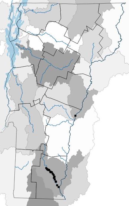
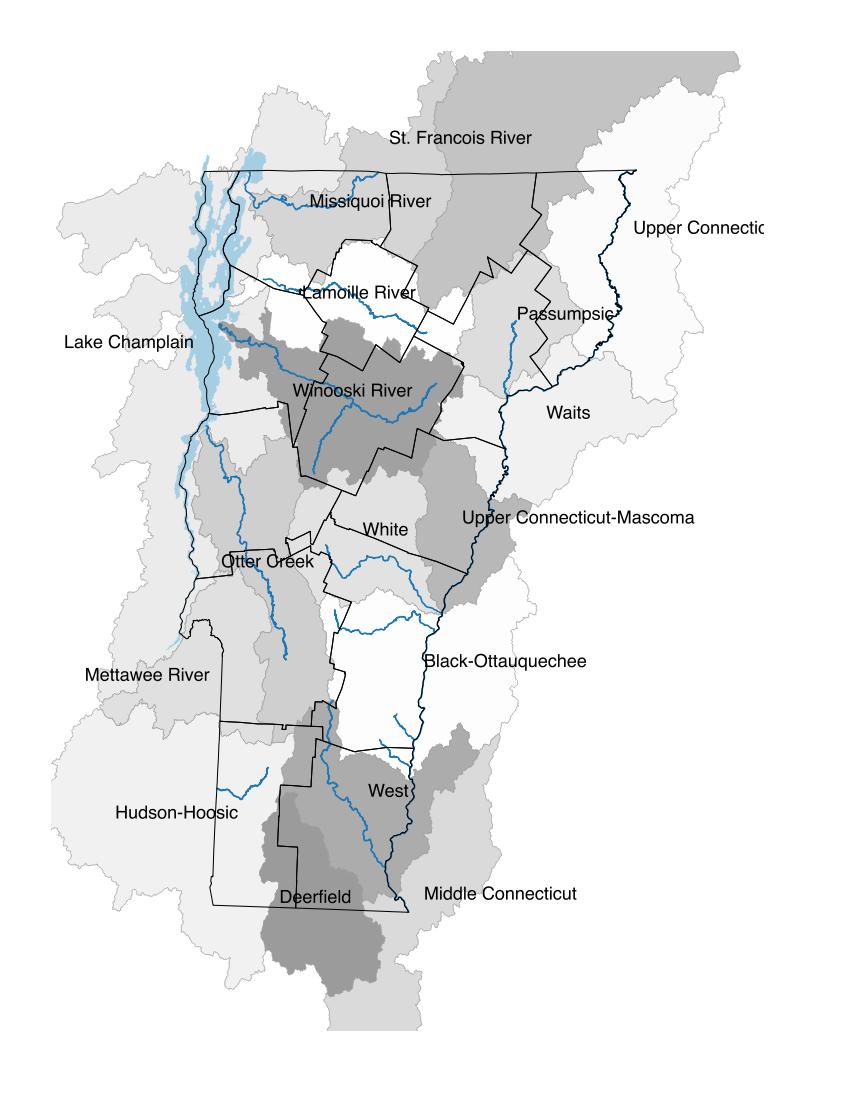
Distribution map has locations where this species has been documented and digitized into the atlas database. Systematic surveys have not been conducted for many species and those surveys that have been conducted have been largely focused on endangered species. Therefore, in some cases, the actual distribution of freshwater mussels may be more extensive than what is presented here. Shaded areas are watershed sub-basins and river main stems are shown.


